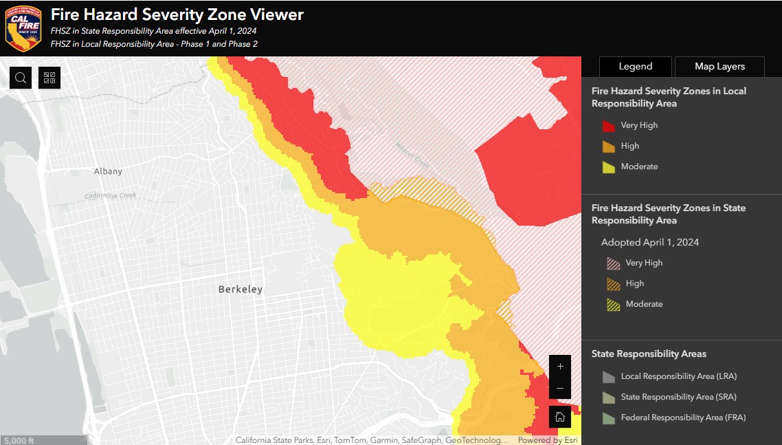
CalFire just released new draft wildfire severity maps for Alameda County and other counties in the north-central part of California. This is part of a rollout across the state that will happen over two months. The new draft maps can be viewed [here](LRA FHSZ - Hub Site Application).
- Cal Fire's draft hazard map drops several Berkeley neighborhoods | BerkeleySide
- California's New Fire Risk Maps Have Huge Impacts for Homeowners - Newsweek
The proposed maps will remain in draft state for a few months, after which they will be finalized in consultation with local jurisdictions.
California’s Insurance Commissioner, Ricardo Lara, said that “The hazard maps won’t affect insurance decisions.” Assumingly, it is because insurance companies use their own risk assessment models.
At first glance, the proposed fire risk maps somewhat downgrade risk for Berkeley and Oakland, since the “Very High Severity Zone” has somewhat shrunk. However, because CalFire now requires three levels of severity to be taken into account by local governments (it used to be only the highest severity in the past), more residents will be affected.
There will likely be consequences for some property owners who might need to enforce more severe firescaping and home hardening requirements, in particular in higher severity zones. The highest severity zone will likely see strong enforcement of Zone 0, the 0-5ft zone around your home, with no vegetation or combustible material allowed.
through Chris Cullander and Jim Hynes